
Question 2
Study the map extract provided on a scale of 1:50,000 and answer the questions that follow.
- On the attached topographical map extract, mark and name the following features using the letters in the brackets:
- ridge (RG);
- col (CL);
- confluence (CF);
- spur (SP);
- isolated hill (IH).
- Shade an area above 950 ft in the north western part of the map.
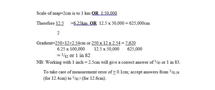
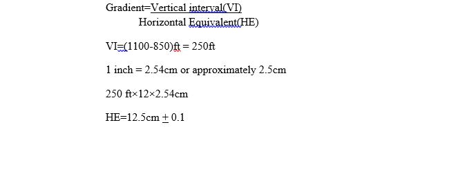
- In your answer booklet, calculate the gradient along the line between points A and B on the map.
- Describe two drainage characteristics of the River Tain.
This was a compulsory question attempted by virtually all candidates and their performance in the question was just fair. Many candidates could not locate the required physical features on the topographical map that was provided. A remedy to this inability could be provided by constant practice on the identification of relief features on topographical maps. The candidates also performed poorly in the computation of gradient on map between points A & B. The required computation is:
The Description of the drainage characteristics of River Tain are:
- the major or largest river in the mapped area
- has many tributaries
- drainage pattern is dendritic
- it flows from northwest to the centre and then eastwards
- it is in its middle course
- it flows through U-shaped valley
- the width of the river is between 10-100ft
- meanders are found in the north-west of the map.
- the northern boundary is Tain forest reserve.
- the slope of the river bed is gentle